
Satellites and AI offer a new way to count elephants

- Satellites and AI can detect and count elephants across complex Botswana landscapes.
- Researchers tested satellite counts against simultaneous aerial surveys in northern Botswana.
- Satellite imagery detected 688 elephants, compared with 816 counted from the aircraft.
- Vegetation remains a major challenge because tree cover can conceal elephants from satellites.
- Satellite monitoring could complement aerial surveys, enabling more frequent elephant population assessments.
 Want to visit Botswana to spot elephants on the ultimate African safari? Learn more about Botswana and browse our top Botswana safaris here. Or, let us plan your handcrafted, unique safari.
Accurate elephant counts underpin conservation decisions, revealing not only how many animals remain, but whether populations are growing, declining or shifting across the landscape. Yet obtaining those numbers across vast areas of Africa is difficult, expensive and infrequent.
In Botswana, home to Africa’s largest population of savannah elephants, national elephant abundance is currently estimated using extensive aerial surveys conducted approximately every four years. These surveys require low-flying aircraft, trained observers, permits, substantial planning and considerable expense.
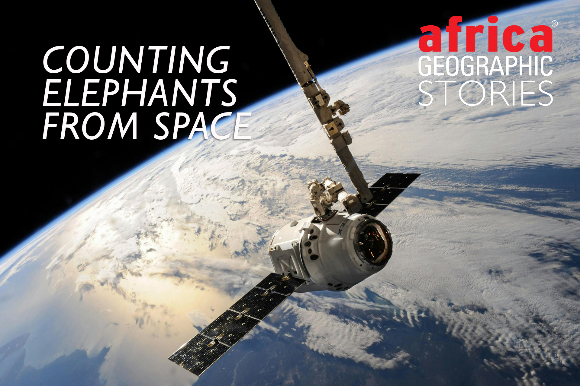
A new study has tested a very different approach: looking down from space.
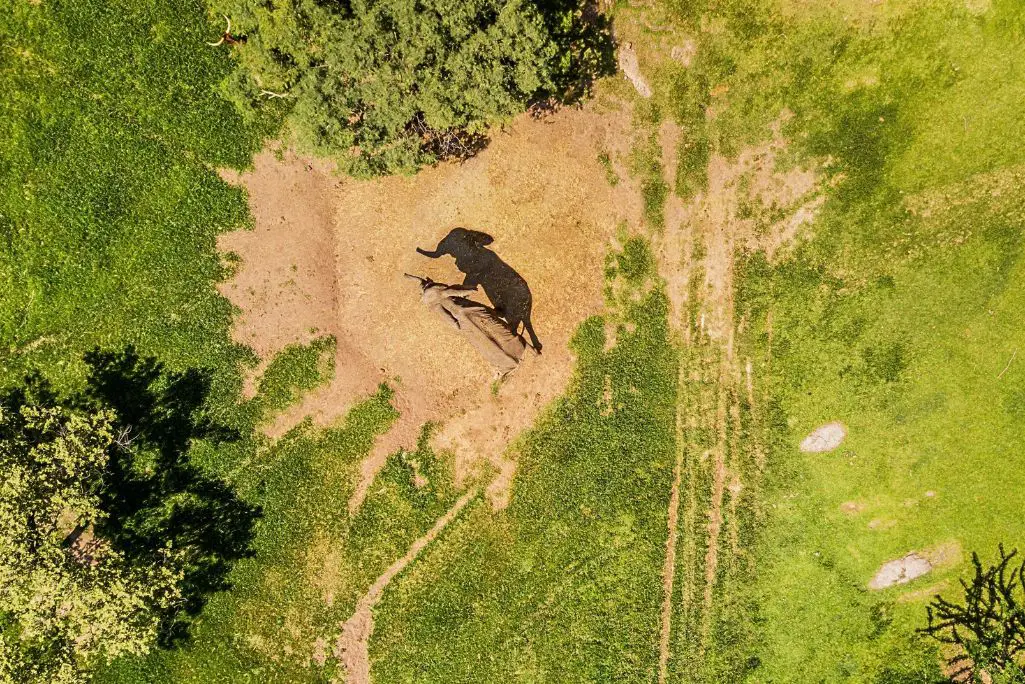
Researchers from the University of Edinburgh, Elephants Without Borders and partner organisations developed a framework combining very high-resolution satellite imagery with artificial intelligence (AI) to detect and count elephants. They then tested the method in northern Botswana, including the first synchronised satellite and aerial wildlife count in the country.
Their results show considerable potential, but also an important limitation. Satellites can find elephants across complex African landscapes, and AI can help count them. For now, however, the technology cannot simply replace conventional aerial surveys.
Teaching AI to recognise an elephant
Wildlife has been counted from satellite images before, but most research has focused on animals in relatively open environments, including whales, seals, walruses and polar bears. According to the study, 88% of satellite wildlife studies have focused on landscapes with minimal obstruction from vegetation.
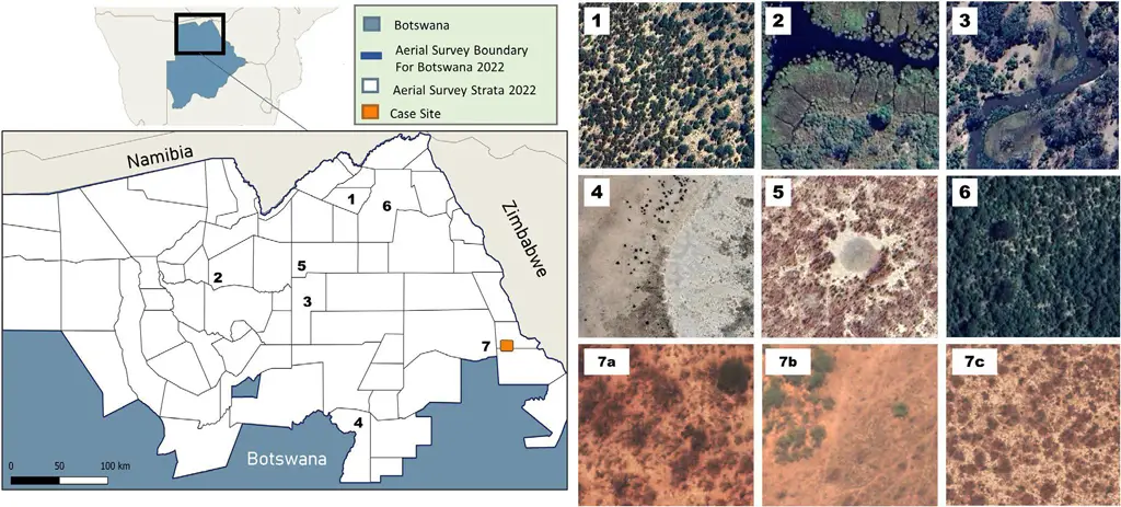
Northern Botswana presents a more difficult test. Elephants move through a varied landscape of woodland, bushland, wetlands and open areas. Trees, branches and shadows can obscure animals or create shapes that resemble them.

The researchers used imagery from Airbus Pleiades Neo satellites, including a 30cm-resolution panchromatic band. They assembled training imagery from elephant hotspots across northern Botswana, using GPS data from 36 collared bull elephants as well as landscape features such as waterholes and rivers to identify areas where elephants were likely to occur.
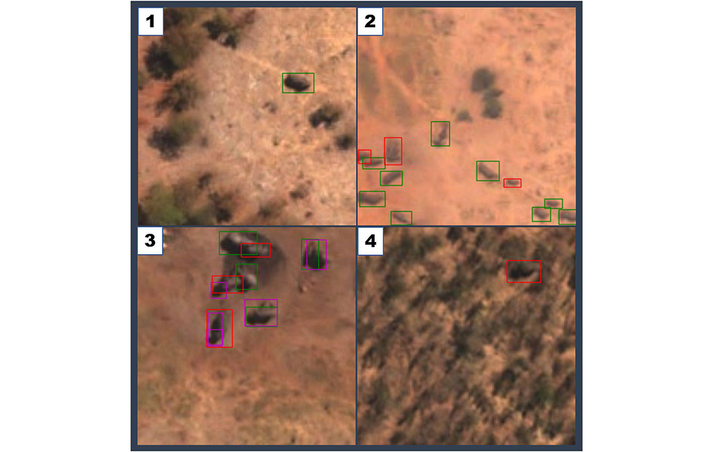
Human annotators first identified elephants in these images. At this resolution, characteristics such as an elephant’s size, colour and shadow can be useful, while herd formation, movement between images and occasionally even ears, tails or trunks can help distinguish animals. But there remains potential for confusion with rhinos, hippos and large bull buffalo.
These labelled images were then used to train an AI object detector based on YOLO, a type of convolutional neural network designed to identify objects within images.
Putting the satellite count to the test
The crucial test came on 6 October 2022 at Ngwasha in northern Botswana.
An aircraft surveyed the study area between 09:16 and 10:40, while the satellite captured an image at 10:24. This provided the researchers with near-simultaneous views of the same elephants using two very different methods.
The aircraft counted 816 elephants within the comparison area. Researchers examining the satellite imagery identified 688 visible elephants.
The satellite therefore recorded 128 fewer elephants – an undercount of 15.7%. The researchers say this is the first demonstration in published literature of elephants being detectable by satellite in Botswana and the first larger-scale satellite elephant detection validated against corresponding ground-truth counts.
The AI results also revealed why automated counting remains challenging. The model performed well when elephants were clearly visible, but struggled with tightly packed herds and animals surrounded by vegetation or lacking strong contrast with the landscape. Rocks could also be incorrectly identified as small elephants.
Importantly, performance declined when the AI encountered imagery that differed from its training data. Changes in shadows, for example, altered the apparent size of elephants and confused the detector. This means an AI system trained successfully in one set of conditions cannot automatically be assumed to perform equally well elsewhere.
The problem of elephants beneath trees
Detecting visible elephants is only part of the challenge. Researchers also need to account for elephants that the satellite cannot see.
This is known as availability bias – animals are present within the survey area but unavailable for detection. In Botswana, vegetation is particularly important. Even landscapes classified as relatively open can contain branches, vegetation edges and shadows capable of hiding elephants in 30cm satellite imagery.
The researchers estimated that 26% of the study terrain was unavailable because of canopy obstruction. Some vegetation classes described as open or sparse had estimated canopy obstruction of 11–47%, when looking for elephants by with satellite.
When the researchers corrected the raw satellite count of 688 elephants for this hidden area, the estimate increased to 929 elephants – 13.8% higher than the aerial count of 816. Its 95% confidence interval ranged from 882 to 997 elephants.
This reversal exposes one of the central problems. Correcting for unseen elephants can substantially alter the final population estimate. The study’s correction assumed elephant density was the same in visible and obscured areas, but the researchers acknowledge this is unlikely to hold across larger landscapes. Elephant use of canopy can vary with temperature, season, proximity to water, disturbance and other factors.
Faster surveys, but greater uncertainty
Satellites nevertheless offer significant practical advantages.
They can image large areas remotely without survey flight permits and could substantially shorten the time required to organise wildlife surveys. Once a functioning AI and statistical pipeline existed, the researchers suggest surveys could potentially be deployed within days and completed within weeks, depending on satellite availability.
There may also be cost advantages. The study’s approximate comparison suggested satellite surveys could cost from US$110 per km² of terrain covered, compared with US$200–300 per km² for an aerial survey using 20% sampling intensity. These figures exclude important fixed costs and are explicitly described by the researchers as approximate.
But aerial surveys currently retain an important advantage: greater confidence in what observers are actually seeing. Satellite surveys introduce additional uncertainty from vegetation, image quality, AI errors and potential confusion between species. Young elephants and carcasses also remain difficult to identify reliably from 30cm imagery.
Not a replacement – yet
The researchers therefore do not propose replacing Botswana’s aerial elephant surveys with satellites.
Instead, the technology may be most useful as a complementary monitoring system. Highly controlled aerial surveys could continue providing less frequent, high-confidence population estimates, while satellite surveys could potentially provide more frequent information between them. This could help researchers identify changes in elephant distribution or local population density sooner.
This distinction is significant in Botswana. Previous analyses of the 2018 Elephants Without Borders aerial survey, and more recent assessments of elephant population trends across Botswana and KAZA, show why national or regional totals alone are not enough. Changes in elephant numbers and distribution at smaller geographical scales can have important conservation implications.
The satellite approach could eventually help fill some of these temporal and geographical gaps. The researchers suggest combining satellite estimates with aerial counts and other information, including GPS tracking, camera traps, citizen science and environmental DNA.
Technology may also remove some current limitations. The study notes that emerging satellites are expected to provide imagery at resolutions of 7–10cm, while newer constellations allow multiple observations each day. Better resolution could reduce misidentification and make more species detectable.
For now, the important advance is not that elephants can simply be counted from space. It is that researchers have begun establishing what is required to turn satellite detections into defensible estimates of wildlife abundance – and where the uncertainty still lies.
Reference
Wilks, R., King, S., King, R., Chase, M.J., Landen, K., McCann, N., Williams, D.R. & Collins, M. (2026). Counting elephants from space: An analytic framework for wildlife abundance surveys in heterogeneous terrain using satellites and AI. Ecological Solutions and Evidence, 7, e70320. https://doi.org/10.1002/2688-8319.70320
Further reading
- The science of counting Kruger’s elephants: New research says Kruger’s elephant numbers have been underestimated, with improved aerial surveys revealing a growing population of elephants
- Elephants are transforming Greater Kruger as landscapes reconnect, revealing new insights into savanna ecology, carbon and conservation. Find out how elephants are reshaping Greater Kruger
- Counting wild animals can be a complicated process, particularly when estimating populations in some of Africa’s massive protected wild areas. Read more about the technology helping conservationists
To comment on this story: Login (or sign up) to our app here - it's a troll-free safe place 🙂.